
Designated Wild and Scenic Rivers
Scroll to the bottom for photo slideshow
The NWA believes that the rivers of Wisconsin and the Upper Peninsula are one of the greatest treasures of the area. This feature describes some background on the Wild and Scenic River designation, and highlights some of these special rivers in the western UP. The Wild and Scenic Rivers act was signed into law by President Lyndon Johnson in 1968 in a time of bi-partisan conservation awareness. Ironically the very first designation of only 8 rivers nationally, included two in Wisconsin, the Wolf and the St. Croix. In a future report we will concentrate on Wisconsin rivers, where here we will highlight the Wild & Scenic Rivers (including the recreational designations) in the western UP, primarily the Ottawa National Forest. These six were designated in 1992!
A National Wild and Scenic River is an official, federal designation that was created by Congress in 1968. It began as a response to the damming, diverting and degrading that had been happening to many of our country’s great waterways. In Michigan 625 miles of rivers are designated “Wild and Scenic.” These rivers possess remarkable scenic, recreational, geologic, fish and wildlife, historic, cultural or other similar values. They and their immediate environments are protected for the benefit and enjoyment of present and future generations. A Wild and Scenic River is not a national park or wilderness area. The idea is not to halt development and use of a river; instead, the goal is to preserve the character of a river. To learn more about our National Wild and Scenic Rivers, visit the official National Park Service web site, the Michigan DNR page about these rivers, and a map of Michigan’s Natural and Wild & Scenic Rivers.
Western Upper Peninsula Wild & Scenic Rivers
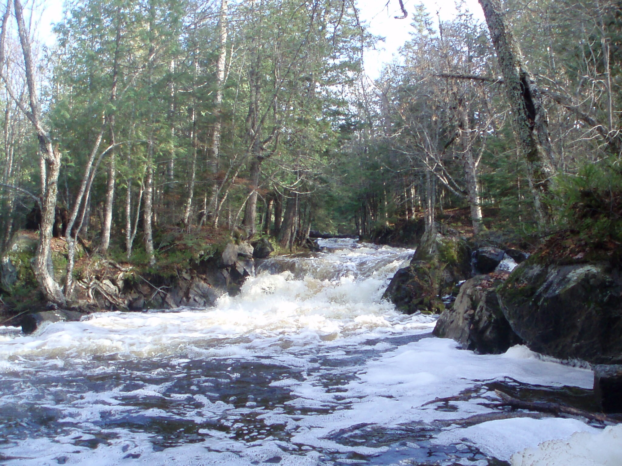
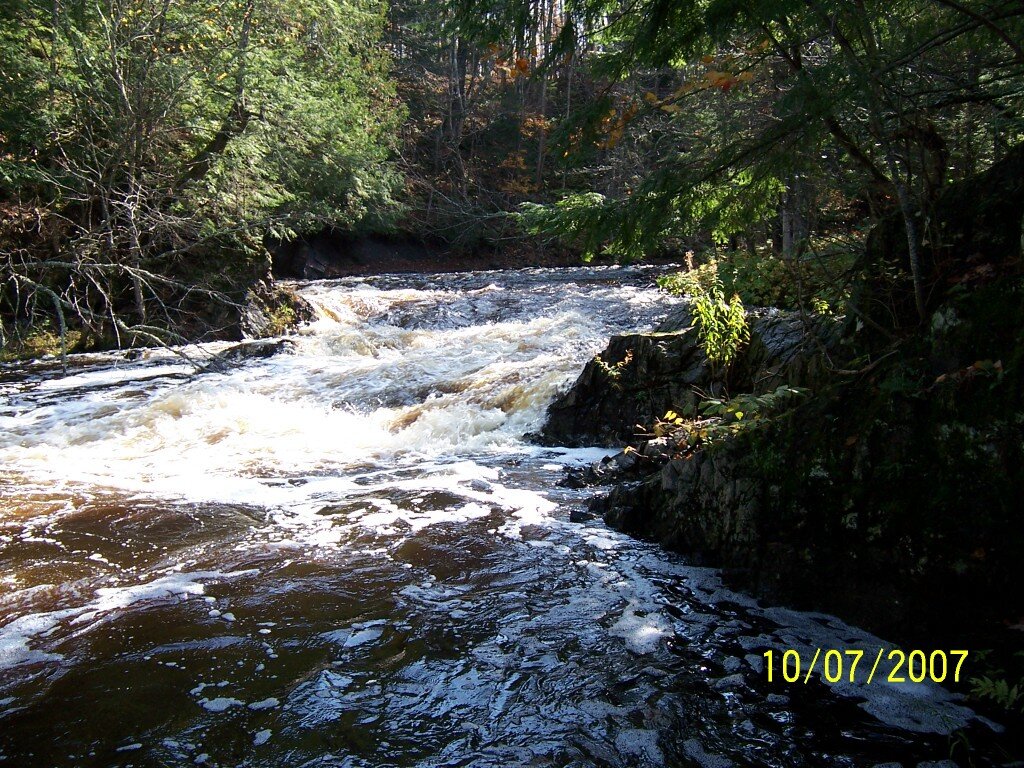
Black River, USFS Designation/Reach: March 3, 1992. From the Ottawa National Forest Boundary to Lake Superior. Classification/Mileage: Scenic — 14.0 miles; Total — 14.0 miles. The Black River provides visitors with outstanding scenery, unique geographical features, superb fisheries, cultural history, and abundant recreation opportunities. The many waterfalls, rapids, and gorge-like landscapes along this river, combined with a mix of large hemlock and eastern white pine, has long been recognized as a must- see resource.
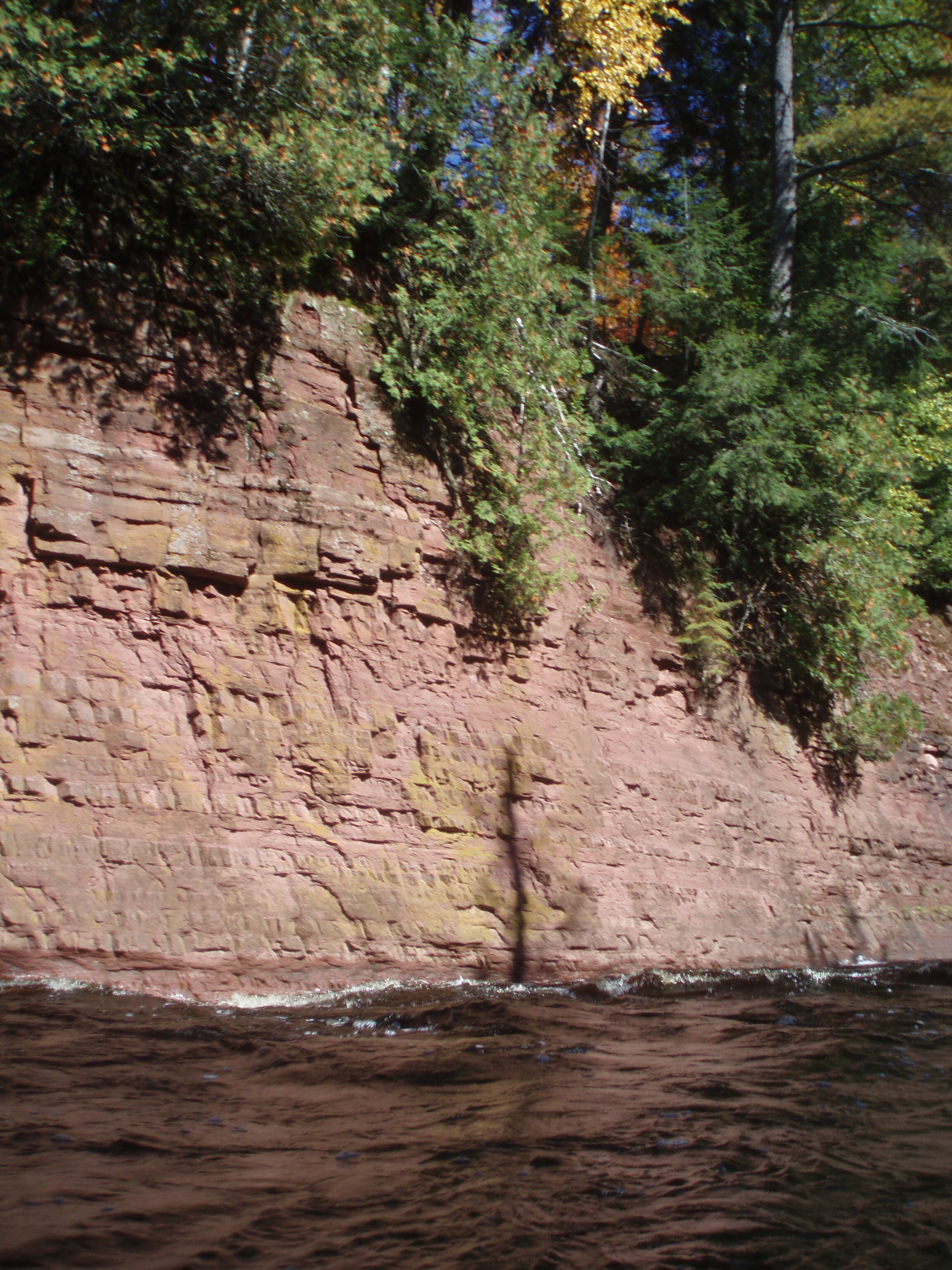
Ontonagon River, USFS (also Blue Ribbon Trout Stream) Designation/Reach: March 3, 1992. The East Branch from its origin to the Ottawa National Forest boundary. The Middle Branch from its origin to the northern boundary of the Ottawa National Forest. The Cisco Branch from its origin at Cisco Lake Dam to its confluence with Ten-Mile Creek south of Ewen. The West Branch from its confluence with Cascade Falls to Victoria Reservoir. Classification/Mileage: Wild — 42.9 miles; Scenic — 41.0 miles; Recreational — 73.5 miles; Total — 157.4 miles. In this true backcountry setting, the gorge-like landscape, exposed sandstone cliffs, and waterfalls provide a unique recreational area for the mid-western United States. The river also has excellent fishing for resident brown trout, Lake Superior run salmon, and steelhead.
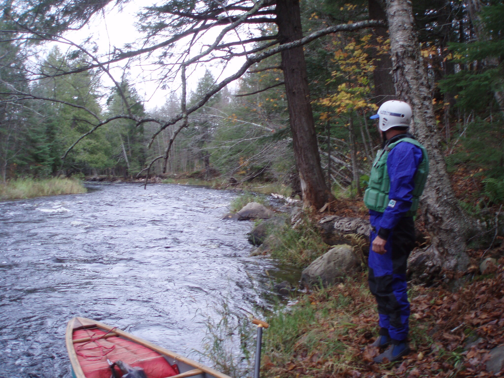
Paint River, USFS (also Blue Ribbon Trout Stream) Designation/Reach: March 3, 1992. The main stem from the confluence of the North and South Branches to the Ottawa National Forest boundary. The North Branch from its origin to its confluence with the South Branch. The South Branch from its origin to its confluence with the North Branch. Classification/Mileage: Recreational — 51.0 miles; Total — 51.0 miles. The main stem of the Paint River is an excellent year-long canoe route. The brook and rainbow trout fishing is outstanding. The historical use of this river for log drives provides many historical interpretive opportunities.
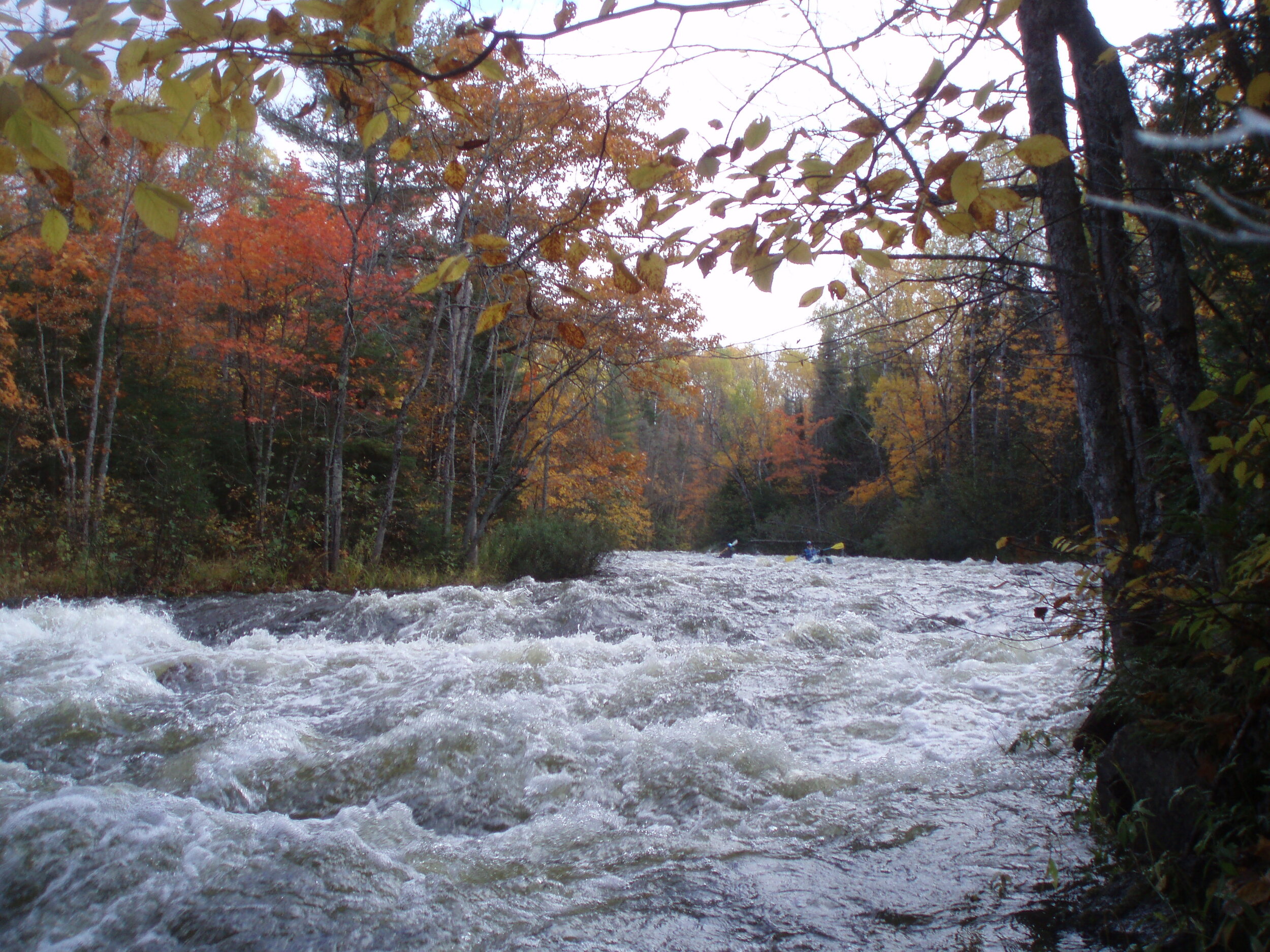
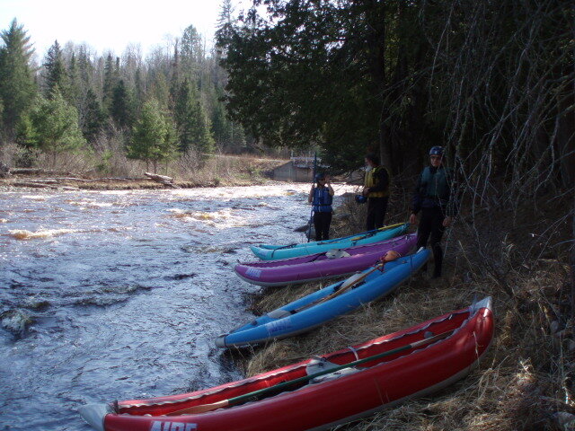
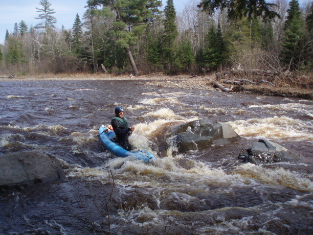
Presque Isle River, USFS Designation/Reach: March 3, 1992. The main stem from the confluence of the East and West Branches to Minnewawa Falls. The East Branch within the Ottawa National Forest. The South Branch within the Ottawa National Forest. The West Branch within the Ottawa National Forest. Classification/Mileage: Scenic — 19.0 miles; Recreational — 38.0 miles; Total — 57.0 miles. Portions of this river are considered by some as the most challenging whitewater river in Michigan, if not in the Midwest. This river is listed as one of the ten North American rivers that “defines the outer edge of contemporary whitewater paddling” (Canoe Magazine). [Note from NWA director Joe Hovel: A raft trip on the Presque Isle on March 31, 1998 was probably the most hair-raising experience of my life. An experience I shall never forget but never wished to repeat!]
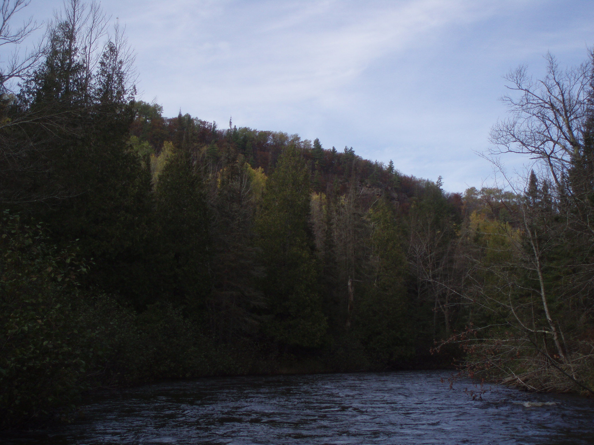
Sturgeon River, USFS (also Blue Ribbon Trout Stream) Designation/Reach: March 3, 1992. From its entry into the Ottawa National Forest to the northern boundary of the Ottawa National Forest. Classification/Mileage: Wild — 16.5 miles; Scenic — 8.5 miles; Total — 25.0 miles. This river flows through a narrow, dissected, gorge-like valley with an average depth of 200-300 feet. Valley walls have slopes of 50-90%, and the river flows through the Sturgeon River Gorge Wilderness. Do visit the Sturgeon River Gorge!
Yellow Dog River, USFS Designation/Reach: March 3, 1992. From its origin at the outlet of Bulldog Lake Dam to the boundary of the Ottawa National Forest. Classification/Mileage: Wild — 4.0; Total — 4.0 miles. The Yellow Dog River drops 240 feet through numerous outcrops and cascades within the McCormick Wilderness. Surrounding vegetation consists of large eastern white pine, eastern hemlock, sugar maple, northern red oak, and other old-growth northern hardwood species.
Thanks to Trails to Trout for assisting in this report. For a full list of Michigan designated Rivers see https://www.trailstotrout.com/resources/wild-and-scenic-rivers/ or https://www.nps.gov/subjects/rivers/michigan.htm Watch for Wisconsin Rivers coming up in a future feature. The other day we received mail using a forever stamp featuring the Ontonagon River, specifically the Cisco Branch and Kakabika Falls. Ask for the Wild & Scenic River stamps at your post office and celebrate a special feature of our conservation treasures. And get out and enjoy these rivers.